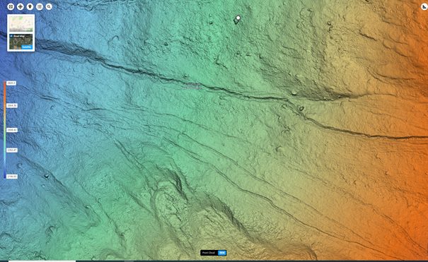
Context. The study of mass changes and energy fluxes across mountain environments has undergone a quantitative evolution, facilitated by the enhanced quality and quantity of available datasets. In recent decades, surveying technologies capable of acquiring topography data with very high-resolution (decimetre and sub-decimetre resolution) have emerged. It is now possible to capture microscale features at an appropriate degree of granularity, thereby enabling the observation of small but frequent surface processes. The abundance of data obtained from Uncrewed Aerial Vehicles (UAV), which are equipped with various sensors (including laser scanners and metric cameras), offers significant opportunities for research and presents a number of challenges.
Objectives. This project proposes the utilisation of repeated very high-resolution topographic surveys for the quantification of landscape changes at two sites in the Valais Alps. For this purpose, at least two UAV surveys equipped with a laser scanner and a metric camera are available. The first site is representative of the glacier forefield of the Moiry Glacier, where the lateral moraine of the Little Ice Age is undergoing rapid morphological changes associated with dead-ice melting and gravitational processes. The second site is located on the western face of a valley side, where mudflows were triggered in 2018. It comprises the morainic bastions of a former steep glacier system, which now provides a larger quantity of sediments to ephemeral mountain streams. These sites provide practical examples of how mountain landscapes can evolve rapidly during the current climate change.
If you are interested, please contact Sara Bonetti (sara.bonetti@epfl.ch) and Sebastian Vivero (sebastian.viveroandrade@epfl.ch).
3D visit to Moiry glacier forefield: https://skfb.ly/p7QKy (2024) and https://skfb.ly/oNQPz (2023)
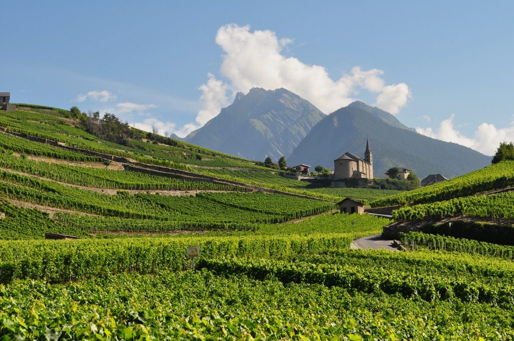
Context. Accurate modeling of plant-soil water relations is crucial for optimizing agricultural production, particularly in light of predicted climate changes (e.g., Tramontini et al., 2013; Martínez-Lüscher et al., 2016). This is particularly relevant in viticulture, where accurate knowledge of terroir effects on the plant response is crucial (van Leeuwen et al., 2020), especially in light of their impacts on grapevine most valuable final product (i.e., wine). Grapevine production in the Valais is a topical example. Here, the unique climatic conditions have made the region the most productive in Switzerland for viticulture. However, predicted hydroclimatic changes (most notably expected increases in temperature and in drought frequency and intensity) will altogether alter such a delicate equilibrium and cause notable challenges associated soil-plant water relations and resulting crop yield and quality.
Objectives. This thesis aims at calibrating and validating a state-of-the-art ecohydrological model against data collected at the Experimental Station for Viticulture and Oenology in Leytron, Canton of Valais (managed by Agroscope). You will use the Tethys and Chloris (T&C) ecohydrological model (Fatichi et al., 2012), adapt it for the description of grapevine dynamics, and use it to quantify soil-plant water dynamics under different management and climatic conditions. The student is expected to actively work on a literature review of the topic (10%), perform numerical simulations using T&C (60%), and critically assess the results (30%). The thesis will be conducted in collaboration with Agroscope.
If you are interested, please contact Sara Bonetti (sara.bonetti@epfl.ch).
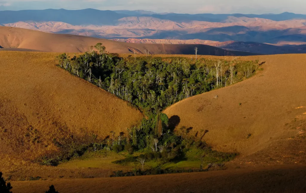
Context. Landscape topography and its time evolution play a crucial role in a variety of ecohydrological and geomorphological processes. For example, the spatial distribution of energy (e.g., radiation) and water (e.g., soil moisture) variables, which are the main drivers of vegetation and nutrients distribution, is highly dependent on the topographic features of a landscape (e.g., elevation, slope, aspect, curvature, drainage area) (Florinsky and Kuryakova, 1996). The amount of solar radiation intercepted by a surface is affected by local slope and aspect (Essery and Marks, 2007), while surface and subsurface water redistribution are strongly influenced by microtopographic attributes such as landscape connectivity, curvature, and slope, thus regulating the local soil moisture available to plants (Dymond et al., 2017). Conversely, vegetation cover influences landscape evolution in many ways, such as providing physical resistance to soil erosion and enhancing soil cohesion (Meng et al., 2022). Despite the significant progress in the past decades, the understanding of potential feedback mechanisms between vegetation and landforms, as mediated by local environmental and climatic conditions, is still limited.
Objectives. This thesis contributes to answering the question “how do vegetation and topography co-evolve”? The student will couple a state-of-the-art spatially distributed ecohydrological model (Tethys- Chloris, Fatichi et al., 2012) and a landscape evolution model (CAESAR-Lisflood, Coulthard et al., 2013) to quantify how landscape evolution impacts the spatial distribution of vegetation and, conversely, how vegetation distribution affects the landscape evolution dynamics. The student is expected to actively work on a literature review of the topic (10%), perform numerical simulations (70%) and critically assess the results (20%).
If you are interested, please contact Sara Bonetti (sara.bonetti@epfl.ch) and Taiqi Lian (taiqi.lian@epfl.ch).
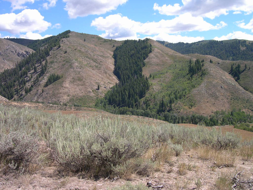
Context. The topography of a landscape is a key feature of the Earth’s surface, as it regulates the spatial distribution of water and energy states which are the main drivers of vegetation and nutrient dynamics as well as soil organic matter distribution. For example, the amount of solar radiation intercepted by a surface is affected by local slope and aspect, while surface and subsurface water redistribution is strongly influenced by micro-topographic attributes such as landscape connectivity, curvature, slope, and drainage area, thus regulating the local soil moisture available to plants.
Objectives. This thesis aims at quantifying the role of local (e.g., slope, aspect) and non-local (e.g., drainage area, shadowing) topographic properties on ecohydrological and biogeochemical fluxes across a broad range of catchment types and climatic conditions. Using the Tethys and Chloris (T&C) ecohydrological model (Fatichi et al., 2012) applied to a synthetic catchment, you will quantify the relative roles of different topographic attributes in determining the spatial variability of water and energy resources and subsequent catchment-scale water, carbon and energy fluxes. The student is expected to actively work on a literature review of the topic (10%), perform numerical simulations using T&C (65%), and critically assess the results (25%).
If you are interested, please contact Sara Bonetti (sara.bonetti@epfl.ch) and Taiqi Lian (taiqi.lian@epfl.ch).
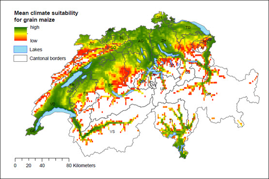
Context. Predicted increase in intensity and duration of extreme events (e.g., droughts, heat waves, heavy rainfall) are critical to agricultural production worldwide (Foley et al., 2011). Particularly, average and seasonal maximum temperatures are projected to continue rising and hydrological droughts are expected to become more frequent and intense (Ukkola et al., 2020), likely leading to extreme plant water deficits and reduced agricultural production (Battisti and Naylor, 2009). In Switzerland, stress can be even higher as mountainous regions, such as the Alps, are more sensitive to the foreseen changes in climate (Ritzel et al., 2023). Understanding how and where climate change will affect crop suitability in Switzerland is thus crucial to inform adaptation and mitigation strategies.
Objectives. This thesis aims at exploring cropland suitability across Switzerland. By leveraging high resolution maps of crop yields, crop-specific harvested areas yield data and soil properties (e.g., texture, pH), you will develop a data-driven model to quantify the impacts of climate change (most notably temperature and rainfall variations) on the main crops produced in Switzerland. The student is expected to actively work on a literature review of the topic (10%), perform data analyses (20%) and numerical simulations (50%), and critically assess the results (20%).
If you are interested, please contact Sara Bonetti (sara.bonetti@epfl.ch) and Francesca Bassani (francesca.bassani@epfl.ch).
Context. Climate change poses a significant threat to the sustainability of agriculture, and climate-smart agricultural practices offer potential solutions to mitigate its effects. The use of cover crops has emerged as a potential strategy to safeguard food production while reducing environmental impacts. While numerous controlled trials have demonstrated the positive effects of cover crops on primary crop yields and soil organic carbon (SOC), these effects can vary based on factors such as climate, soil types, and crop species. Understanding these variables is crucial for optimizing the adoption of cover crops in different agricultural contexts.
Objectives. This project aims to conduct a meta-analysis of the effects of cover crops on one of the effects (yield, soil organic carbon or greenhouse gas emissions). By compiling data from published literature, the project will quantify how cover crops influence SOC across varying conditions. The student will extract and analyze relevant data from an existing database of studies, assessing trends and identifying key factors influencing the effectiveness of cover crops. The student’s responsibilities will include:
- Literature Review (15%): conducting a thorough review of the topic.
- Data Extraction (65%): extracting and organizing data from relevant studies.
- Critical Assessment (20%): analyzing the data and evaluating the results.
If you are interested, please contact Sara Bonetti (sara.bonetti@epfl.ch) and Qiming Sun (qiming.sun@epfl.ch).
Completed master projects (PDMs):
- Hydrological modeling and integrated rainwater management strategies for adapting Charleroi to climate change (2024), Victor Deblon, EPFL – CHANGE, EcoRes (BE)
- Global assessment of agricultural water sustainability under future climate changes (2024), Qiming Sun, EPFL – CHANGE
- Quantifying uncertainty in agricultural water sustainability indicators for soybean and wheat crops (2023), Rémi Elian Raphaël Depalle, EPFL – CHANGE
- Simulating crop water and carbon dynamics: assessment of model performances (2023), David Simon-Vermot, EPFL – CHANGE
- Évaluation du ruissellement à l’échelle locale et analyse de l’efficacité de mesures de protection (2023), Lucas Lometti, EPFL – CHANGE and PL-LCH, CSD Ingénieurs (CH).
- Physical and numerical model study of the Trient Torrent from the gorges to the Rhone River (2023), Marie Joséphine Gaiffe, EPFL – CHANGE and PL-LCH.
Completed semester projects:
- Evaluation of ecosystem services provided by Fribourg’s cantonal roads (2024), Anthony Jean Michel Varaillon-Divanis, SIE Individual Project
- Hybrid modeling of stomatal resistance using a complex ecohydrological model and eddy covariance measurements (2024), Ismaïl Sahbane, IC Semester Project
- Quantifying the potential benefits of climate-smart agricultural practices (2024), Mikael Marcos Gonzalez, SIE Individual Project
- Impact of topography on catchment water and carbon dynamics (2024), Sven Henrioux, SIE Individual Project
- Effect of rainfall spatio-temporal variability on soil erosion dynamics (2024), Noemi Esther Steiger, SIE Individual Project
- Modeling stormwater treatment basin aging dynamics (2024), Rafik Tewfik, SIE Individual Project
- Water sustainability of Swiss crop imports (2023), Soren Tiago Rasmussen, SIE Individual Project
- Swiss water impact of imported maize and cocoa beans in their producing countries (2023), Sébastien Hill Rogers, SIE Individual Project