An adequate road and traffic management system is essential for the development of sustainable infrastructures for transportation. Navigation technologies and GIS play a key role in the development of new services and applications in the intelligent transportation systems (ITS).
In this context TOPO lab develops a research activity for a better integration of geomatics technologies within the transportation domain
This research domain is mainly focusing on:
- Location referencing for road applications
- Road databases: modelling and data quality
- GNSS positioning for ITS applications
Main research partners:
- European Commission – Framework Programmes
- COST: European Cooperation in Science and Technology
- VSS: Swiss association of road and transportation experts, http://www.vss.ch
- ASTRA: Federal road office, http://www.astra.admin.ch
Past projects in Switzerland:
- SYRROU: VSS 1999, Nr 452, Spatial reference systems for road data
- AGRAM: VSS 2000/362, Study on the acquisition of a reference road geometry
- METAROUTE: VSS 2000/364, Management of the data quality for the spatial reference system and for road geometry
- NAVAROU: VSS 2002/706, Potential use of car navigation data for the road maintenance
- SATELROU: VSS 2003/903, Perspectives and applications of the navigation systems for the intelligent transportation systems and for the road information system
All technical reports are available on the VSS website: www.mobilityplatform.ch/
Research activity in Europe
NEARCTIS: Network of excellence (NoE) in co-operative traffic management.
The network NEARCTIS gathers a significant part of the European academic community working on road traffic management, traffic modelling, traffic control, communication and positioning technologies. EPFL is involved in this NoE with the participation of LAVOC, TRANSP-OR and TOPO.
The final brochure is now available !
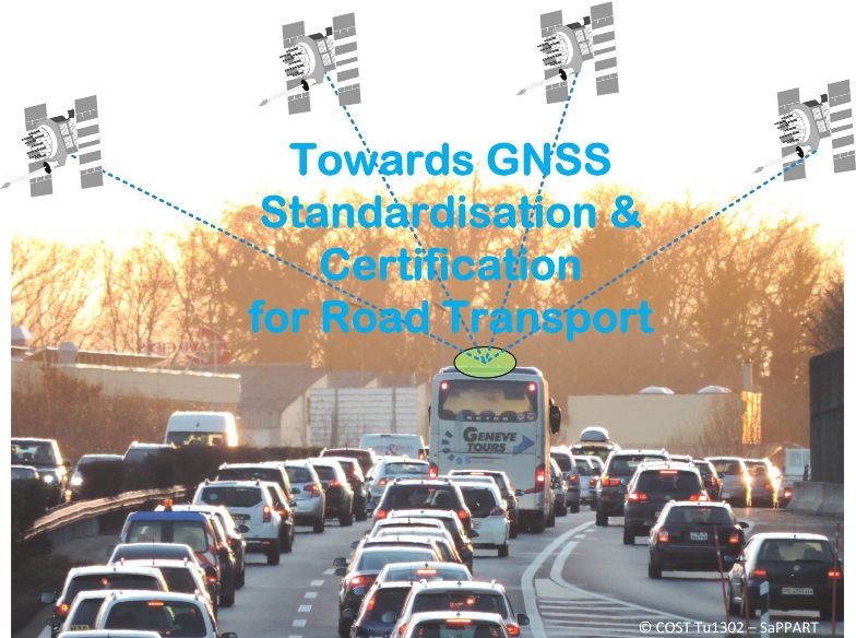
COST Action TU 1302 – SaPPART (Satellite Positioning Performance Assessment fro Road Transport)
This Action brings together experts in GNSS, ITS and mobility to address the open issues and guarantee the success of the standardisation for underpinning certification initiatives. The Action will provide 4 deliverables and will propose a unified framework for definition and assessment of performance for the GNSS-based positioning terminals. This framework is expected to pave the way for certified terminals, which is expected to result in a significantly accelerated use of GNSS-based ITS and mobility applications.
Download: SaPPART – flyer (version 2014)
Warning
Please note that the publication lists from Infoscience integrated into the EPFL website, lab or people pages are frozen following the launch of the new version of platform. The owners of these pages are invited to recreate their publication list from Infoscience. For any assistance, please consult the Infoscience help or contact support.
SaPPART Guidelines, Performance assessment of positioning terminal
Lyon, France: IFSTTAR, 2018-04-05.Safer roads GNSS: a strong position
Thinking Highways; Connected North America. 2017. p. 56-58.The SaPPART COST Action: main outcomes and deliverables
SaPPART final conference: “High Quality Positioning: a Key to Success for Autonomous Driving”, Brussels, Belgium, October 4, 2017.COST TU1302- SaPPART Handbook: Assessment of positioning performance in ITS applications
Lyon, France: IFSTTAR, 2017.Assessment of positioning accuracy of vehicle trajectories for different road applications
Iet Intelligent Transport Systems. 2017. Vol. 11, num. 3, p. 113-125. DOI : 10.1049/iet-its.2016.0049.Evaluer la qualité de l’information trafic
Route et trafic. 2016. Vol. 9/2016, num. 9, p. 26-29.Géolocalisation et crowdsourcing pour l’information trafic
Geosummit 2016, Bern, Suisse, 7-9 Juin 2016.Intégration des véhicules intelligents dans un contexte multimodal
28e Colloque Franco-Suisse; Route et trafic, Strasbourg, France, 28-29 Avril 2016.Le spatial et les GNSS au congrès mondial des ITS à Bordeaux
Route et trafic. 2015. Vol. 12/2015, num. 12, p. 10-12.SaPPART: positioning integrity in challenging road applications
Ahorn 2015, Wildhaus, CH, November 26-27, 2015.Positioning Accuracy of Vehicle Trajectories for Road Applications
2015. ITS World Congress 2015, Bordeaux, France, October, 5-9, 2015.COST TU1302- SaPPART White Paper – Better use of Global Navigation Satellite Systems for safer and greener transport
Lyon, France: IFSTTAR, 2015.Position accuracy with redundant MEMS IMU for road applications
European Journal of Navigation. 2015. Vol. 13, num. 2, p. 4-12.Crowdsourcing pour la mobilité et les transports
Strasse und Verkehr. 2015. Vol. 07-08 2015, num. 07-08, p. 32-35.Position Accuracy with Redundant MEMS IMU for Road Applications
2015. European Navigation Conference GNSS, Bordeaux, France, April 7-10, 2015.Technologies de localisation: principes et caractéristiques
ITS: Mieux connaître le GNSS pour changer de paradigme; journée ATEC-ITS France, Paris, March 16, 2015.Le chaos dû au trafic est-il une menace pour la Suisse?
Route et Trafic. 2014. Vol. 11, num. 11/2014, p. 16-17.Intégrité du positionnement dans le transport routier
Strasse und Verkehr. 2014. Vol. 09, num. 09-14, p. 14-17.Scénarios et projets pour les ITS coopératifs en Suisse
26e Colloque F-CH sur la route et le trafic, Lyon (Bron), F, March,20, 2014.SaPPART – Satellite Positioning Performance Assessment for Road Transport
5th TRA – Transport Research Arena, Paris, F, April, 14-17, 2014.Qualité et avalanche de données: est-ce compatible?
Strasse und Verkehr = Route et trafic. 2014. num. 3-2014, p. 39-41.Nearctis : vers une recherche harmonisée en gestion du trafic et systèmes coopératifs
Recherche Transports Sécurité. 2013. Vol. 29, num. 113, p. 107-123. DOI : 10.4074/S076189801300203.Les systèmes coopératifs dans les transports : une approche coordonnée qui nécessite une affirmation des champs de compétence
Recherche Transports Sécurité. 2013. Vol. 29, num. 113, p. 105-106. DOI : 10.4074/S0761898013002021.Big Data: un enjeu majeur pour gérer le trafic et la mobilité
Strasse und Verkehr = Route et trafic. 2013. Vol. 9-2013, num. 9, p. 31-33.Perspectives et applications des méthodes de navigation pour la télématique des transports routiers et pour le système d’information de la route
2010
NAVAROU – Potentiel d’utilisation des données routières de la navigation automobile pour l’entretien routier
2008
A mobile mapping system for road data capture via a single camera
Advances in Mobile Mapping Technology; London: Taylor & Francis, 2007.Système temps réel de lever précis de la géométrie des axes routiers
2006. LCPC – Journées scientifiques de l’ingénieur 2006, Marne-la-Vallée, December 5-6, 2006.METAROUTE – Gestion de la qualité des données du repérage spatial et de la géométrie des axes routiers
2006