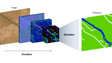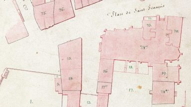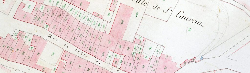
The “Berney” cadastre is the main source for understanding the urban development of Lausanne in the first half of the 19th century. It was established between 1827 and 1831 and covers the entire Lausanne region. The project of vectorization of the Berney cadastre aims to make it digitally intelligible and searchable. Its scientific potential is exceptional in two respects. Firstly, it is one of the few cadastres of this period to extensively document peri-urban areas. Indeed, farms and hamlets in the surrounding area are mapped in detail within a very large radius. It is therefore a valuable source for documenting the process of urbanization, as well as for studying the history of the economy prior to the industrial revolution, from the point of view of the territory. The Time Machine Unit team invented new computational methods to solve the problem of automatic large-scale extraction of all graphical elements. Our research developed an automatic segmentation methodology based on neural networks.
The “Berney” cadastre also consists of a valuable and detailed legend describing land use and naming the owners that was likewise extracted.
Interactive map
The digital map allows to explore the information contained in the land register from different angles. Analyze the map and consult statistics on property owners !
For a more pleasant viewing experience, click on the ![]() button to display the map in full screen mode.
button to display the map in full screen mode.
Coordination : Isabella Di Lenardo
Data production : Irene Bianchi, Rémi Petitpierre, Lucas Rappo
Web integration: Nicolas Mermoud-Ghraichy